Coulson Boothill Cemetery
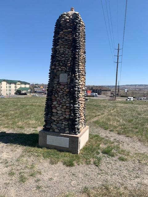
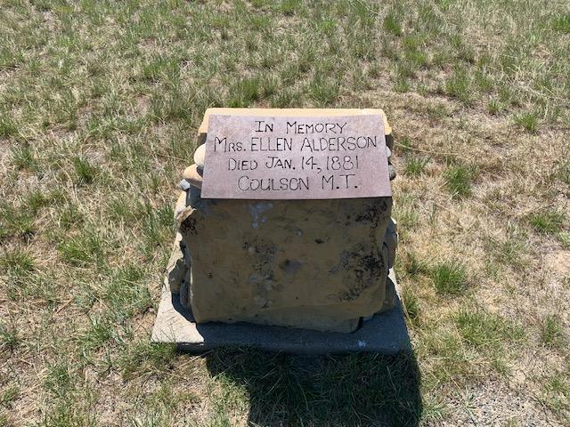
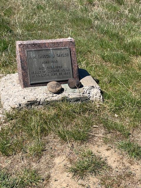
This high, rocky outcropping above the confluence of the Yellowstone River and Alkali Creek is central to interpreting Billings area history. For millennia, the Apsáalooke (Crow) Nation used this area for camping and spiritual activities such as fasting, vision quests, and burials. William Clark and members of the Corps of Discovery passed nearby in 1806 on their way back to the Missouri River, signaling change and conflict as Euro-Americans encroached into Indigenous homelands. Piikuni (Blackfeet) warriors killed a group of fur trappers near here in 1823, a smallpox epidemic decimated a nearby Apsáalooke camp, and the Baker Fight five miles northeast ignited tensions between the U.S. Army and numerous Indigenous nations in 1872. Despite bloody battles between the Army and Indian nations to the south in 1876-77, a group of Bozeman businessmen established a town near this site in 1877. Although they strategically located it along the future Northern Pacific Railway route, they named it Coulson after the steamboat company, the Coulson Packet Line. Residents soon established their town cemetery here next to The Place of the Skulls, an Apsáalooke burial site. When the Northern Pacific platted Billings to the west in 1882, Coulson residents moved to Billings, leaving only the cemetery to mark its existence. Ignatius D. O’Donnell, the influential Billings civic leader, irrigation expert, and community historian, later became owner of the Coulson cemetery. He preserved it and built a river stone obelisk in 1920 to mark the burials. O’Donnell later deeded the cemetery to Billings, and a system of parks and trails has since developed from it.
Images